Use Of A Soil Description
A soil description paints a word picture of the soil. While such a picture has appeal for a soil-ahollic such as yourself, its practical value comes from being able to interpret the horizon characteristics and what they mean for engineering, drainage, rooting depth, water storage, aeration, infiltration rate and history of the site.
Descriptions also enable comparison and classification of soils from different locations such as when making a soil map, or when wanting to find similar soils in other regions.
For example:

 |
horizon depth and soil texture can be used to predict the water storage for a soil. E.g. a soil with a shallow sandy topsoil on a sandy subsoil holds less water than one with a deep topsoil.
|
|
changes with depth in soil colour, abundance and colour of mottles and colour of any coatings can be used to predict the drainage condition of a soil, the depth and range of fluctuation of a soil water table as well as its seasonal duration.
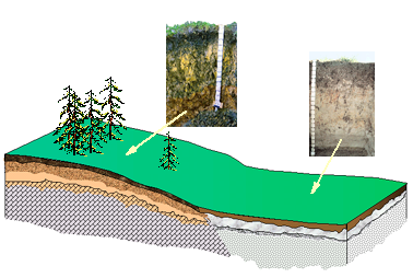
E.g. soil colour changes from brown to white or grey at the depth where there is a water table. If this depth is also mottled then the water table fluctuates. A soil with brown colours and brown mottles indicates that there are brief periods of saturation but a water table is uncommon or absent.
|
|
combinations of texture, structure, consistence and coatings can be used to estimate the infiltration rate of water through the various horizons. E.g. a soil horizon with medium polyhedral structure, loamy in texture with low inter-aggregate packing and no coatings has a moderate permeability (20 - 64 mm/h).
|
|
the structure and consistence of a horizon can be used to predict rooting depth and identify any pans or compacted layers that may be hindering rooting or drainage. The depth and thickness description of pans or compacted layers will determine whether they can be ameliorated or not.
|
|
layers of buried topsoil can indicate a site with a history of accumulation such as may occur if the site was regularly covered with flood debris, or received eroded material from an adjacent slope.
|